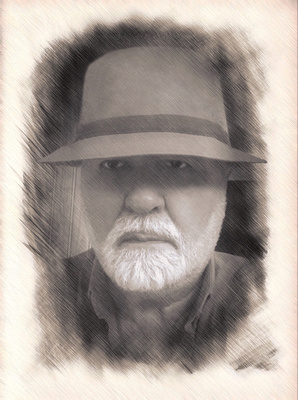
The Ascent to Mt. Whitney
"The best camera is the one that you have with you" are words of photographic wisdom that were never more true than on Labor Day weekend, 1970. On that bright Saturday, I was ascending the Sierra Nevada Mountain range on my way to the top of Mt. Whitney at 14,505 feet, the tallest mountain in the continental USA.
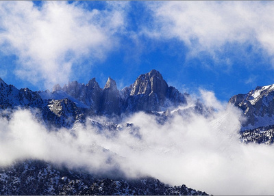
 Mt. Whitney (Source cannot be attributed)
This is no easy hiking excursion. Of the tens of thousands of hikers who yearly plan the adventure, only about one-third actually make it to the peak. Many succumb to altitude sickness, to which I can attest is quite overcoming to even a healthy and fit 23-year old man. Somewhere around the 13,700 foot altitude, I was struck with the sickness and could barely shuffle my feet up the sloping pathway to achievement. There was I, plodding along as though I was a very old man, one slow agonizing step at a time. Right foot forward ... then the slow and deliberate advancement of the left foot. Repeat. One foot ... at ... a ... time. And hallucinating through it all like it was an out-of-body experience. I'm thinking of telling my hiking companion, Ed Wetzel, that I can't make it; go on without me. Damn it! I've come this far. I must find a way to continue! It was only through the encouraging words of Ed, that I was able to overcome the pain and press onward. When Ed exclaimed, "I can see the top!",

 View of Summit from Trail Crest - Ed: "I can see the top!"
I was motivated to carry on at a much faster clip through probably a sudden rush of adrenalin. And to the top Ed and I made our way, and landed our tired aching bodies.
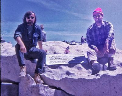
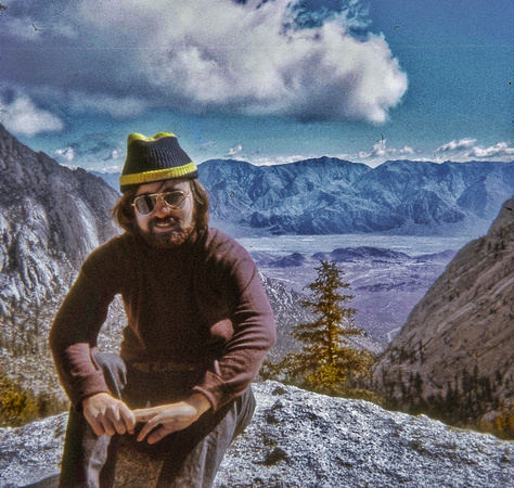
 Doug & Ed Celebrate Their Achievement
This adventure all began on our arrival Friday evening at Whitney Portal, a 8,360 foot elevated base camp where we spent the night trying to get acclimated to the high altitude. Up early the next morning, bright-eyed and bushy-tailed, we registered our names as hikers who intended to camp overnight at 12,000 feet, make our way to the peak by lunchtime the following day, and return to base camp by dusk on Sunday.
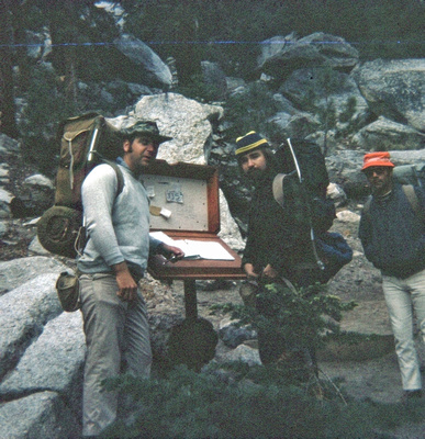
 Ed & Doug Registering Hike at 8,360 Feet - Photo Bombed!
Before us lay a 22-mile round trip excursion up and down the side of a mountain flush with the beautiful scenery of the Sierra Nevada's. We would be traversing a trail with an elevation gain of over 6,100 feet. The route crosses the west side of the eastern Sierras at 8.2 miles, displaying endless peaks and a lake-strewn granite basin to the west, and then traverses the remaining 2.5 miles along the mountain crest to the summit, with stunning views all the way.
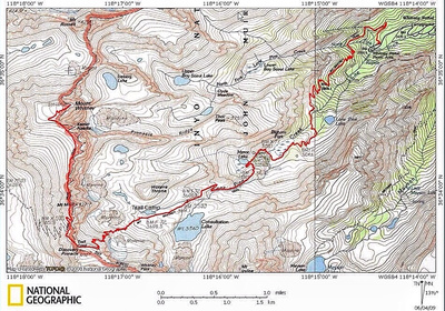
 The Route to the Top
I was outfitted with a loaded backpack provided by Ed and an old summer sleeping bag that I used back in my days of outdoor camping with my buddies from Junior High School. That bag would prove to be totally inadequate for what would lie ahead that night at 12,000 feet.
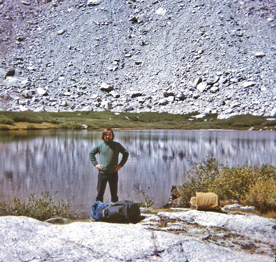
 Doug arrives at high camp with his totally inadequate sleeping bag, 12,000 Feet
Ed and I constructed a lean-to with a tarp anchored against a boulder that lay along flat ground adjacent to a mountain lake.
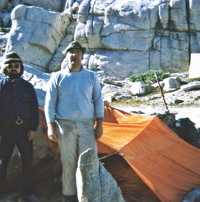
 Doug & Ed Stand Proudly Before Their High Camp
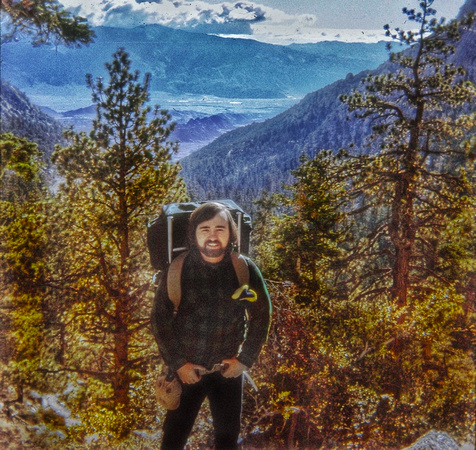
We ate dinner, and as the sun settled and the wind kicked up, we hunkered down for a long night bundled side by side to gather some rest before departing to the summit in the morning. Oh my, what a cold, bone-chilling night it was. Using a layered approach, I still was not prepared with proper clothing gear to weather the wintry-like, high altitude temperatures. I remember having a long sleeve undershirt, sweater and thin windbreaker to wear, plus a heavy wool green-plaid shirt with me. Of course the sleeping bag was not down filled. I shivered through the entire night and needless to say did not gather any sleep. This would not help me the next day when I hit the proverbial wall of thin air at 13,700 feet as I described earlier.
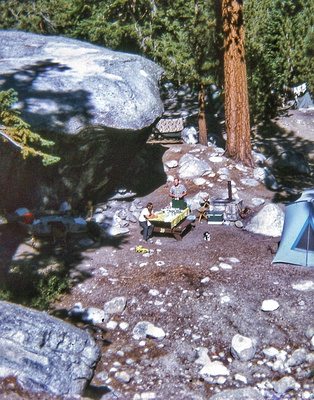
 Ed & Doug Return to Base Camp where the Ladies, Charlie, and Scamp the Cat greet them
The pictures below document our excursion up to and through the mountainside tree line, along the rocky switchback trail, and up the long, challenging summit crest trail to the mountain peak. Ed was the photographer with his Kodak five-and-dime camera. He loaded it with one roll of slide film and took a total of 34 images including one by his wife Diane. It is astonishing what a somewhat primitive 70's film camera can deliver with a little help from modern day post processing applications. Yes, the images are grainy, have streaks and other strange artifacts visible in the shots. But 46 years later, the images bring Ed and I much joy and fond memories of a different time and place where we decided to test our manhood up the slopes of the California Sierra's.
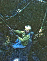

Ed & Diane's son, Charlie, fishing at base camp.
Update (Sept 18, 2016): My fellow Mt. Whitney companion, Ed Wetzel, reminded me of an amusing anecdote associated with the ascent of this remarkable mountain. While Ed and I were slumped over with nausea from altitude sickness, an elderly trekker clad in shorts and a red plaid shirt trotted passed us (yes, trotted). We both cursed him under our reduced and heavy breath, and in a fit of schadenfreude, we vowed to uncaringly pass by his prone body on the way up to the peak. About an hour later, as we were still ascending and wrestling with sickness, as Ed describes it, the fellow passed by us again "skipping down the trail". With a proud smirk on his face, the fit old man says to us, "Hang in there boys, it's not much further". At that moment, I think if either one of us had an ounce of energy, we would have extended our leg before his "skipping" gait and watched in amusement as he tumbled down the trail. :-)
D W Orr
Environmentalist, Historic Preservationist, Weimaraner/Dachshund Companion, Blogger, and Photographer
Harford County, Maryland
September 3, 2016
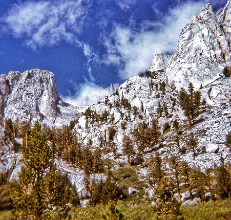
 First view of Mt. Whitney hiding among the clouds along the tree line trail
Doug at Tree Line - About 10,000 Feet
Doug Above Tree Line
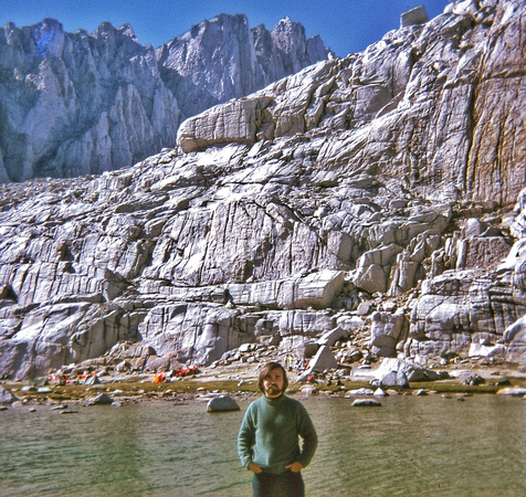
 Doug at High Camp With Summit in Background
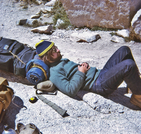
 Doug resting on his cheap sleeping bag roll before setting up high camp
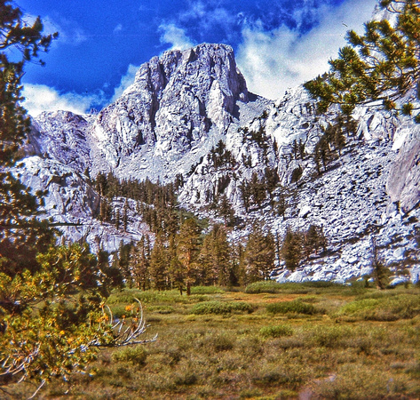
 View of Wotan's Throne from High Camp
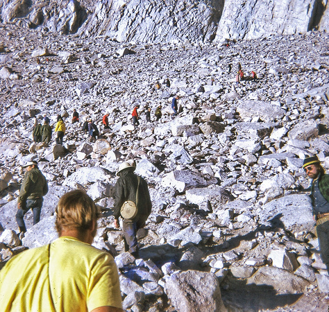
 From high camp, Doug looks on incredulously at hikers along switchback trail. Where did all these people materialize from overnight?
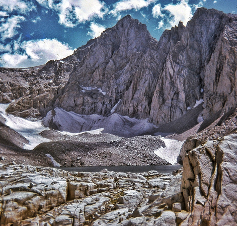
 Next Day, Sunday, On the Way to the Summit - Snowfields!
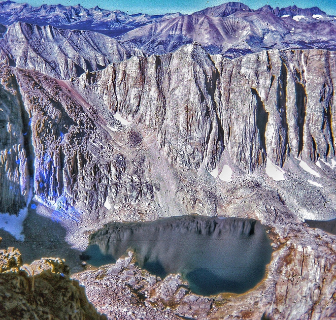
 On the Way to the Summit a Snowmelt Pond - View from Switchback Trail
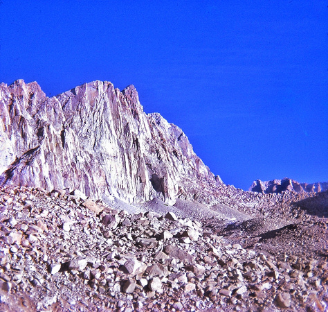
 View of Summit from Switchback Trail
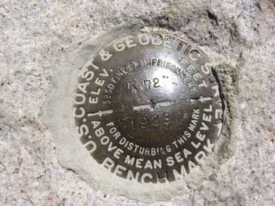
Doug At The Peak - Between my feet is the round USGS brass elevation benchmark disk. I am drinking a canned Mai-Tai cocktail mix and flashing the victory/peace sign. On my left hip, a box of crackers; right hip, sunglass case holder. About 11,000 feet below me is the flat, arid Owens Valley.
The USGS Elevation Benchmark Disk (Source cannot be attributed)
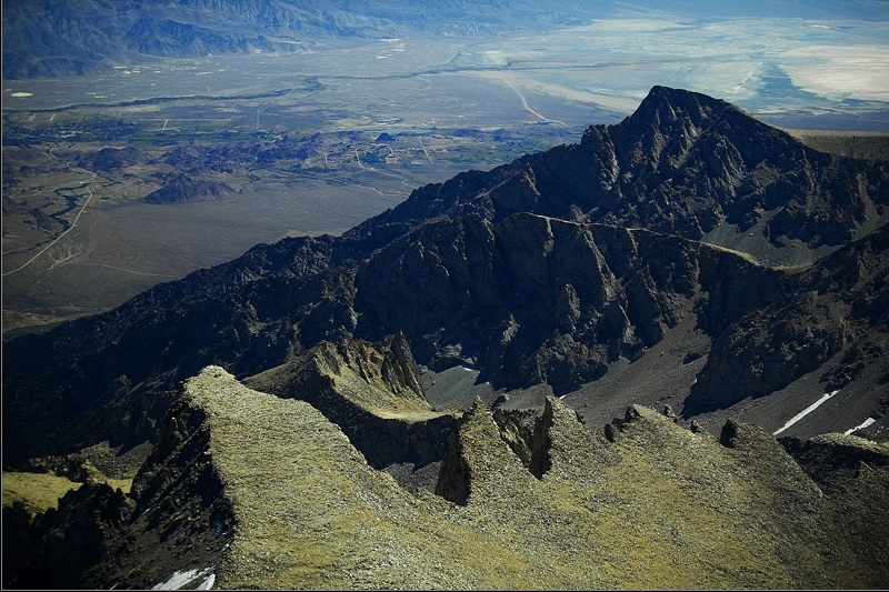
 Aerial View of Mt. Whitney - Far Left Pinnacle (Source cannot be attributed)
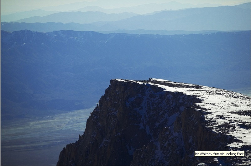
 Aerial View of the Peak at Mt. Whitney (Source cannot be attributed)
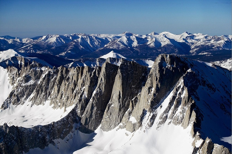
 Aerial View of Mt. Whitney, Second Peak from Right (Source cannot be attributed)
